https://cuilcaghlakelands.org/geosite/cuilcagh-hikers-trail/
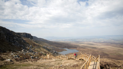
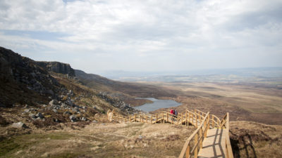
Please note that access to the summit of Cuilcagh Mountain beyond the Cuilcagh Boardwalk Trail viewing platform is currently closed. We ask visitors to keep to the designated path and to remain within the confines of the viewing platform. The habitat in this area is fragile and we kindly request that walkers respect the environment and do not stray from the designated route. Your cooperation with this is appreciated.
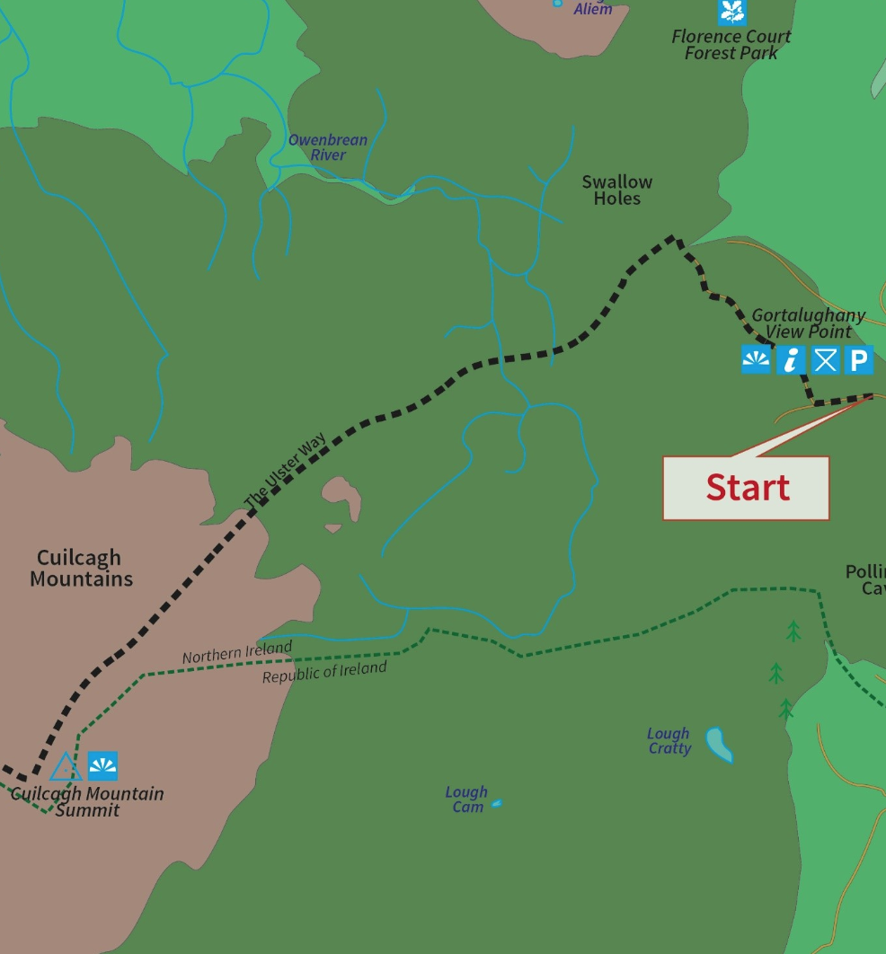
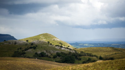
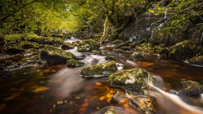
The Cuilcagh Hikers Trail is a marked linear route that will appeal to experienced walkers who enjoy spectacular views and are interested in undertaking a vigorous, challenging walk in the wilderness. The terrain consists of a mountain path so some parts of the route can be very wet and boggy, particularly after a rainy period.
The Cuilcagh Hikers Trail is one of the walks on offer within Cuilcagh Mountain Park and is Section Three of the Cuilcagh Way, a waymarked route that stretches for 20.5 miles through a breath-taking patchwork of habitats in west Fermanagh. The route provides stunning views, fascinating geology, incredible wildlife, important archaeological sites and fascinating natural history. The trail can be walked in sections.
Cuilcagh Hikers Trail
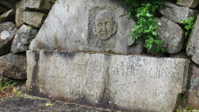
As the route begins on the mountain there is no significant climb until the steep and vigorous 300m scramble up the mountain face through rocky outcrops. Arriving on the summit you cannot miss the ancient cairn (the remains of a burial mound dating from the Bronze Age 2,500 – 500 BC). The summit provides a great vantage point to view the picturesque lowlands of County Fermanagh and Cavan and on an exceptionally clear day you can see both the Irish Sea and the Atlantic Ocean along with several surrounding counties.
Please be aware:
For safety, conservation and insurance reasons, walk leaders and event organisers are not permitted to organise, advertise, or run an event of any nature in, or along any section of the Cuilcagh Way, where participants exceed 20, without prior written consent from the Marble Arch Caves. Application forms are available from the Marble Arch Caves and should be submitted well in advance of a planned walk or event. Please contact mac@fermanaghomagh.com for more information.
The trail is a richly varied one in terms of topography and features and includes walking over a glacial landscape in a mountainous environment passing by dry valleys, limestone pavement, mountain rivers and sandstone outcrops. This area is also managed by the Royal Society for the Protection of Birds so keep alert for signs of the rare Golden Plover nesting in the area.
Derrylahan, Cavan
As the surface rising of Ireland’s longest river, the Shannon Pot’s fame can be ...
Glangevlin, Cavan
An opportunity to escape from the stresses of modern life into a paradise of tra...
Derrylahan, Cavan
This tranquil Lough is part of a complex system of underground rivers associated...
Marlbank, Fermanagh
Cuilcagh Mountain Park takes in 2,500 hectares on the northern slopes of Cuilcag...
Marlbank, Fermanagh
This delightful short walk leads you to one of the most incredible views in the ...
Marlbank, Fermanagh
The reserve's limestone grassland is managed through conservation grazing and is...
Florence Court, Fermanagh
Corridors of lofty trees, dynamic rivers, rambling stone field walls, a rich tre...
Enniskillen, Fermanagh
The trail meanders along a farmland track, through one of the largest expanses o...
Distances are from Cuilcagh Hikers Trail
This is a cooperation project between Fermanagh and Omagh District Council and Cavan County Council.
This element of the project is part funded under Priority 6 (LEADER) of the Northern Ireland Rural Development Programme 2014-2020 by the Department of Agriculture, Environment and Rural Affairs and the European Union. We would like to acknowledge the assistance of County Cavan Local Community Development Committee (LCDC), Cavan County Council, Breffni Integrated CLG, Department of Rural and Community Development, the EU and EAFRD in part-funding this project. Funded by the Irish Government Under the Leader Programme 2014-2020.