https://cuilcaghlakelands.org/geosite/cavan-way/
The Cavan Way, is a National Trail situated in the centre of a great inland recreation area stretching from the Erne Lakes in Fermanagh to the North Leitrim Glens. It links the Ulster Way at Blacklion with the Leitrim Way at Dowra and is part of the Beara-Breifne Way. It also links many of the sites within the Cuilcagh Lakelands UNESCO Global Geopark.
The Cavan Way is a 26km (16 miles) linear walking route which can be commenced at either Blacklion or Dowra. The route has been designed to showcases the amazing landscapes in West Cavan, from the magical Shannon Pot, mythical source of the River Shannon to Cavan Burren Park, one of the finest relict landscapes in Ireland, to the majestic open heath and woodlands outside Dowra – you are sure not be disappointed!.
The terrain consists predominantly of quiet roads, forest trails and open moorland. The trail is divided into 2 sections:
Section 1 – Blacklion to Shannon Pot
Distance: 13km
Route Type: Linear
Assent: 330m
Waymarking: Yellow arrow on Black Background
No Dogs are permitted
Starting point (Blacklion) Grid Reference: H 08127 38063; Latitude 54.291420 Longitude -7.8759366
To download a map of the route click here
Section 2 – Shannon Pot to Dowra
Distance: 13km
Route Type: Linear
Assent: 330m
Waymarking: Yellow arrow on Black Background
No Dogs are permitted
Starting point (Dowra) Grid Reference: G 99039 26791; Latitude 54.190207 Longitude -8.0154737
To download a route map for this section click here
To download a map of the full Cavan Way Route click here
The Geopark are members of Leave No Trace and we ask you please to adhere to their guiding principles. For more information please visit www.leavenotraceireland.org.
For more information on the Cavan Way please visit
Blacklion, Cavan
The Blacklion Village Trail, also known as the Cathal Buí Trail is a perfect spo...
Belcoo, Fermanagh
The Cottage Lawn is an amenity area in the village of Belcoo on the shores of Lo...
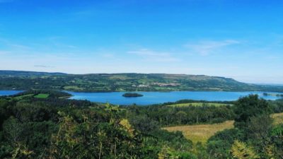
Toam, Cavan
Lough MacNean is a large freshwater lake divided into two parts.
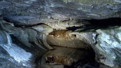
Moneygashel, Cavan
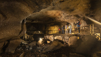
This cave is an excellent example of the hundreds of kilometres of cave system...
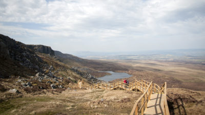
Belcoo, Fermanagh
From here you will be able to see Upper and Lower Lough MacNean, the village of ...
Moneygashel, Cavan
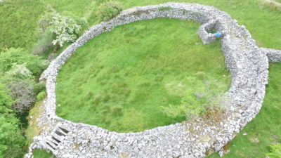
Theremains of three stone Cashels, one of which has been described as 'the fines...
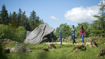
Burren, Cavan
A mythical, spiritual landscape of monuments, megalithic tombs, hut sites and pr...
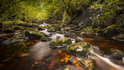
Marlbank, Fermanagh
The narrow-steep sided gorge of the Cladagh Glen is one of the most picturesque ...
Distances are from Cavan Way
This is a cooperation project between Fermanagh and Omagh District Council and Cavan County Council.
This element of the project is part funded under Priority 6 (LEADER) of the Northern Ireland Rural Development Programme 2014-2020 by the Department of Agriculture, Environment and Rural Affairs and the European Union. We would like to acknowledge the assistance of County Cavan Local Community Development Committee (LCDC), Cavan County Council, Breffni Integrated CLG, Department of Rural and Community Development, the EU and EAFRD in part-funding this project. Funded by the Irish Government Under the Leader Programme 2014-2020.