https://cuilcaghlakelands.org/geosite/turbet-island-belturbet/
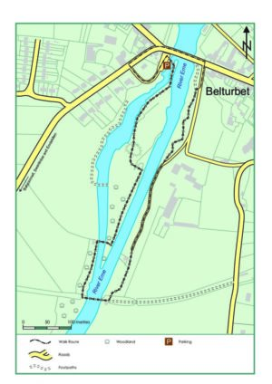
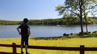
Turbet Island is located on the northwest side of Belturbet town just across the bridge on the River Erne. The castle is believed to be one of the first major settlements at the site of Belturbet. Turbet island and the Motte and Bailey is a wonderful place to go for a relaxing walk, have a picnic, and get lost in the beauty of nature. It is easily accessible by car or by foot and all trails are fully accessible for wheelchairs.
Facilities: Car parking, interpretation and the Turbet Island Walk. Shops, restaurants/cafes and accommodation are all available in the village of Belturbet.
Turbet Island Looped Walk Belturbet
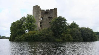
The site has a motte, a steep sided mound of earth with a flat top, and a bailey, an attached enclosed area that would have contained houses and other buildings. The remains of a small sub circular stone structure can be seen from the summit of the mot
The motte was one of seven fortifications built to secure a roadway that would isolate the section of the Ulster province that was still under indigenous Irish control.
Turbet Island motte and bailey had been abandoned by the Anglo-Normans before 1233. After this, the O’Reilly’s took the site over. It is believed that once the O’Reilly’s took ownership of the site, they continued to construct a castle. The site can be accessed via a footbridge which is located beside the main bridge over the River Erne.
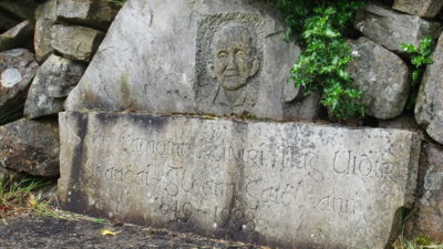
This site is highly valued by local communities, as a place of incredible historical significance. It is believed that it may be the first ever settlement established in this area, making it an incredible display of Ireland’s history.
It is also true that Turbet Island was the home of an exciting discovery. The first ever remnants in Europe of the prehistoric Woolly Mammoth were discovered here, which is truly incredible!
This site is also home to some magnificent bird species, and the River Erne has the pleasure of hosting protected species such as the Whooper Swan and the Greenland White-Fronted Goose.
This trail is a Sport Ireland accredited Trail.
The Geopark are members of Leave No Trace Ireland and we ask you please to adhere to their guiding principles. For more information please visit www.leavenotraceireland.org.
Cornagee, Cavan
Cornagee translates from Irish as ‘rounded windy hill’ and on many days of the y...
Castlesaunderson, Cavan
The story of Castle Saunderson is marked by fire and blood, conquest, and divisi...
Ballyconnell, Cavan
The Woodford Canal, also known as the Shannon-Erne Waterway, flows through Bally...
Drumalane, Cavan
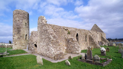
An intriguing monastic site of Drumlane includes an abbey, a monastery and a rem...
Altachullion Lower, Cavan
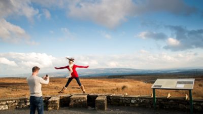
A great opportunity to see contrasting and diverse views, as well as a rare chan...
Tullydermot, Cavan
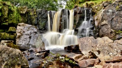
This picturesque waterfall enjoys easy access and is situated under the shadow o...
Killeshandra, Cavan
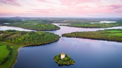
The castle is located on a small island on Lough Oughter, which is a complex maz...
Killashandra, Cavan
If you’re after a quiet walk with all but birdsong to interrupt the tranquillity...
Distances are from Turbet Island Looped Walk Belturbet
This is a cooperation project between Fermanagh and Omagh District Council and Cavan County Council.
This element of the project is part funded under Priority 6 (LEADER) of the Northern Ireland Rural Development Programme 2014-2020 by the Department of Agriculture, Environment and Rural Affairs and the European Union. We would like to acknowledge the assistance of County Cavan Local Community Development Committee (LCDC), Cavan County Council, Breffni Integrated CLG, Department of Rural and Community Development, the EU and EAFRD in part-funding this project. Funded by the Irish Government Under the Leader Programme 2014-2020.