https://cuilcaghlakelands.org/itinerary/cavan-drumlins-itinerary/
This tranquil journey around the drumlin landscapes of Cavan starts at Turbet Island in the small town of Belturbet in County Cavan. The route continues through peaceful, rolling countryside containing some of the finest glacial landscapes in Ireland and some exceptional historical sites dating back to early Christian times.
Distance: 60km /37.3miles
Time: approx 4 hours
Turbet Island is home to an Anglo-Norman motte, a steep-sided mound of earth with a flat top and bailey, an attached enclosed area that would have contained houses and other buildings. The island was an ideal crossing point on the River Erne and was probably the first major settlement in the town of Belturbet. The motte and bailey were abandoned by 1233 and the island was taken over by the O’Reilly chieftains who are thought to have constructed a stone castle on the site.
The village of Milltown unsurprisingly gets its name from a mill that was located in the village, and that was part of the Annsley Estate. The former name of the village was Belnaleck or Béal Ath na Leice meaning ‘mouth of the ford of the flagstones’.
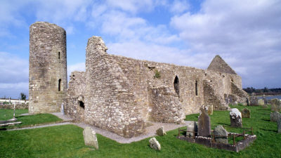
The site of Drumlane Abbey contains a church and a round tower and is not far from the village of Milltown. The abbey dates back to the year 555 and the founder is believed to be Saint Colmcille. The name Saint Mogue is often associated with the site but it is now believed that the foundation is much older than his time.
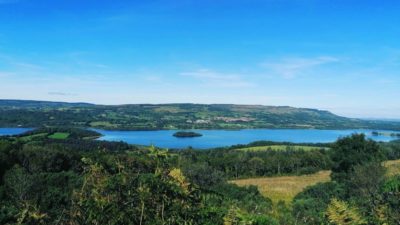
Rann Point is located on the shored of Lough Oughter, a complex maze of waterways, islands and some ninety small lakes along the course of the River Erne. The islands are a reminder of Ireland’s icy past and formed as ridges of sediment sculpted into place by huge ice sheets, some up to 800 metres thick. The ridges are a glacial feature called ribbed moraines and the ones found here in County Cavan are amongs some of the largest in the world.
Clogh Oughter Castle can be clearly seen from Rann Point. This circular Anglo-Norman tower is situated on a man-made island in the middle of Lough Oughter and was built by the Anglo-Norman de Lacy family in the early 13th century when they tried to conquer the local Irish Chieftains.
This 6km long looped trail is part of Fáilte Ireland’s Looped Walk Network and begins at the Town Lake in Killeshandra. Part of the walk takes you through the old Castle Hamilton Demesne, located on lands that were granted to Sir Alexander Hamilton as part of the Plantation of Ulster in 1610.
Killeshandra is situated in the heart of Ireland’s lakeland region most of which formed as a direct result of huge ice sheets that melted 13,000 years ago. It is a thriving village centred on the dairy industry and tourism. Killeshandra has been designated as an Angling Centre of Excellence and is a hub for angling holidays in the northwest of Ireland.
The village of Crossdoney is famous for its granite rock which formed beneath the surface of the Earth over 400 million years ago. Igneous rocks such as Granite formed from molton rocks when immense heat was generated within the Earth’s crust. The Crossdoney granite is only visible in a small inaccessible quarry just outside the village but it plays an important part in the geological history of the area.
The name Kilmore, or An Chill Mhór translates literally as the Great Church, and the original church on this site was built by Saint Feithlimidh in the 6th Century. The church was rebuilt in the 15th Century and was given permission to be a bishop’s cathedral. Following the English Reformation the cathedral was taken over by the Church of Ireland. The present cathedral was built in 1858 on the site of the former Bishop’s Palace, after the former cathedral was described as ‘decayed, dilapidated and too small’. The old cathedral was to be demolished but it was saved and renovated and is now used as a parochial hall.
Cavan Town or Cavan as it is known comes from the Irish an Cabhán, meaning ‘the hollow’. The name comes from the fact that the town is located in a hollow, surrounded by the glacial hills, or drumlins, that dominate the landscape. The town itself is thought to have originated in the 13th Century when the O’Reilly clan established a castle there, accompanied by the formation of the Franciscan monastery at around the same time.
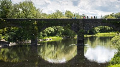
The small town of Butlersbridge is made up of a single street dominated by a beautiful stone church, and a matching cut stone bridge that crosses over the Annalee River. The history of the town dates back to Neolithic times, about 6000 years ago when early farmers would have settled in the area. In more recent times, the area would have been ruled by the O’Reilly clan right up until the Plantation of Ulster in the early 17th Century when the O’Reilly lands were confiscated and granted to an English tenant named Sir Stephen Butler from where the town gets its name.
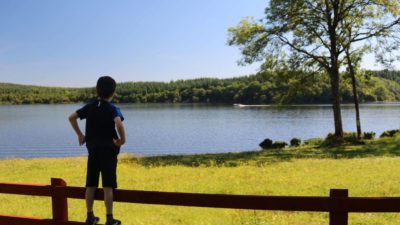
The amenity site on the shores of Annagh Lough offers access to the wildfowl sanctuary that makes up part of the Lough Oughter Special Area of Conservation. Amongst the many wildfowl species found in and around the lake shores are whooper swans, tufted ducks, cormorants, Greenland white-fronted geese, great crested grebes, wigeons, and pochards.
Belturbet, Cavan
Turbet island and the Motte and Bailey is a wonderful place to go for a relaxing...
Drumalane, Cavan
An intriguing monastic site of Drumlane includes an abbey, a monastery and a rem...
Killashandra, Cavan
If you’re after a quiet walk with all but birdsong to interrupt the tranquillity...
Take your time to explore the fascinating, picturesque and unique landscapes tha...
The Cuilcagh Mountain route takes you all the way round the majestic Cuilcagh Mo...
